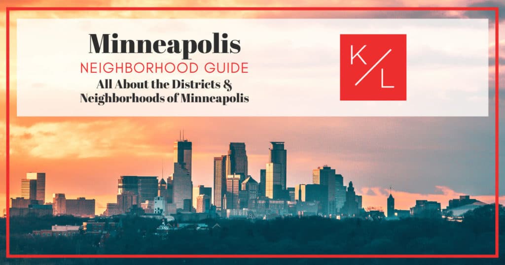
Minneapolis Neighborhoods: Minneapolis, MN Neighborhoods and Districts Guide
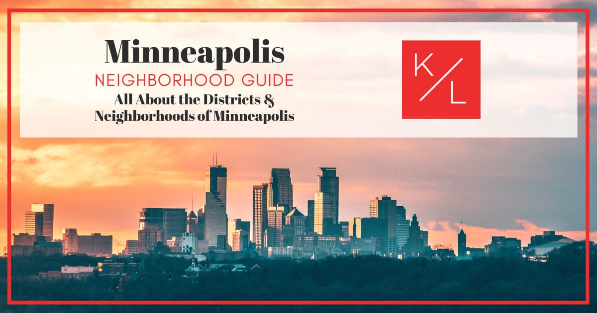
Neighborhoods and Districts in Minneapolis

As Minnesota’s largest, most-populous city, Minneapolis forms part of the Twin Cities, along with the state capital, St. Paul. Minneapolis is in Hennepin County and has a population of approximately 429,606 residents, making it the second-most densely populated city in the region.

The Twin Cities metro and surrounding suburbs are home to about 3.64 million people. Minneapolis is officially divided into 11 communities, each with between four and 13 neighborhoods. However, despite these official boundaries and labels, colloquial references persist in many areas, and residents often use generalized geographical descriptions rather than the official names defined by the City Council. House-hunters in Minneapolis may find the following guide to Minneapolis neighborhoods helpful.

Parts of Minneapolis

The Minneapolis City Council has the legislative authority to divide the city into its official communities and neighborhoods, defining the boundaries for each. These boundaries do not coincide with the city’s wards, however. Unlike the boundaries of communities and neighborhoods, the boundaries for wards are adjusted every 10 years following the census.

The 11 communities in Minneapolis each contain several defined neighborhoods. These 11 communities include Calhoun Isles, Camden, Central, Longfellow, Near North, Nokomis, Northeast, Phillips, Powderhorn, Southwest, and University.

In addition to the city’s official residential neighborhoods, Minneapolis is home to a number of unofficial districts, most tied to commercial districts or prominent thoroughfares. These districts often do not correspond to the official neighborhoods because they span multiple residential neighborhoods and even multiple communities.

An example includes the Lake Street district, running the width of the southern portion of the city, crossing three business districts and bordering a dozen neighborhoods.

Calhoun Isles

Calhoun Isles Zip Codes

  • 55403
  • 55405
  • 55408
  • 55416

Calhoun Isles is located along the west-central area of Minneapolis and is home to nine distinct neighborhoods. The community is bordered by Basset Creek, Theodore Wirth Park, Lyndale Avenue, 36th Street and Frances Avenue. Proximity to Interstate 394 offers easy access to other areas of the city and its suburbs.

As of the last census, the population of Calhoun Isles was 29,913 residents. It has a population density of about 5,431 people per square mile, lower than the city’s average.

Calhoun Isles offers residents access to several lakes and is known for its natural scenic beauty. The community also appeals to residents with its mix of urban amenities, combined with upscale luxury homes.

Calhoun Isles is home to the city’s Uptown District, known for its unique retail and nightlife. The Minneapolis Sculpture Garden and Walker Art Center are also located there.

Calhoun Isles Neighborhoods

Calhoun Isles features nine official neighborhoods, including the Cedar Isles Dean neighborhood, which gets its unique name from Cedar Lake, Lakes of the Isles, and Dean Parkway. The community also includes the Lowry Hill neighborhood, known for its Victorian-style homes. Calhoun Isles is also home to the Kenwood neighborhood, known for its mansion-lined parkways.

The Calhoun Isles community has much to offer its residents, from unique architecture that ranges from Victorian to Frank Lloyd Wright homes, to its robust retail and entertainment districts. The community’s multiple lakes offer not just recreational opportunities, but also provide a scenic and serene background to its neighborhoods.

Camden

Camden Zip Codes

  • 55411
  • 55412
  • 55430

The Camden community is situated in the upper half of Minneapolis’ north side. It is bordered by 53rd Avenue North to the north, Xerxes Avenue North to the west, Lowry Avenue North to the south, and the Mississippi River to the east.

About 28,778 residents call the Camden community home. The district features a shopping mall as well as several parks. It is particularly known for its World War I memorial to all local WWI soldiers. With a tree planted in honor of each local resident who served and died at war, the community’s Victory Memorial Drive is the country’s largest WWI memorial.

Camden is known for its quiet neighborhoods, as well as its proximity to the city’s business center. The community’s affordable homes appeal to residents.

Camden Neighborhoods

The Camden community is divided into seven distinct neighborhoods, including the McKinley neighborhood, known for its bungalows, small stucco Tudors and wood-framed homes, as well as Perkins Hill Park. Camden is also home to Victory neighborhood, known as the neighborhood of north Minneapolis’ factory and mill workers at the turn of the 20th century.

In addition to its residential areas, Camden is the location for the Humboldt and Camden industrial areas. Although primarily residential, Camden features several schools, parks, and a variety of businesses. Residents can also enjoy local food markets and community gardens. Camden is connected to Northeast Minneapolis by the Camden and Lowry Avenue bridges.

Central

Central Zip Codes

  • 55401
  • 55402
  • 55403
  • 55404
  • 55405
  • 55411
  • 55415
  • 55454
  • 55487

As its name would suggest, the Central community can be found in the center of Minneapolis and includes downtown’s primary business district. Because of this, the community is sometimes referred to informally as downtown Minneapolis. The community is bordered by the Mississippi River, Plymouth Avenue, Interstate 35 West, Interstate 94, and Lyndale and Hennepin Avenues.

The community is not all business, however; Central also includes residential neighborhoods. Residents enjoy living within proximity to the city’s core entertainment and sporting event venues, including First Avenue and Target Center. The community offers residents a broad array of restaurants, bars, and retail shops.

Central’s population density is about 16,606 people per square mile, more than twice the population density of the city on average. The community has a population of 51,288 residents.

Prominent businesses headquartered within the Central community include Target, US Bank, and CBS affiliate WCCO-TV.

Central Neighborhoods

The Central community consists of six official neighborhoods, including the North Loop neighborhood, known locally as the Warehouse District. The neighborhood includes the Minneapolis Warehouse Historic District, listed on the National Register of Historic Places. The community is also home to Elliot Park, one of the Minneapolis’ oldest neighborhoods, with residential development dating back as far as 1856.

Living in the Central community enables residents to have convenient access to Minneapolis’ many restaurants, theaters, shopping, and downtown attractions. The community’s business district serves as headquarters for several Fortune 500 companies, including Target and U.S. Bank. The Central community also serves as the location for the Minnesota Orchestra and Mall of America Field, formerly known as the Metrodome.

Longfellow

Longfellow Zip Codes

  • 55404
  • 55406
  • 55417

The Longfellow community is located in the southeast corner of Minneapolis. The community is nearly 5 square miles in size and has a population of approximately 27,775 residents.

Minneapolis first acquired land in Longfellow in 1881, with the final half of the community annexed in 1887. The community was largely developed between 1906 and the 1920s, at a time when streetcar and residential rail offered a reliable commute to the city’s core. The Longfellow community is known for its bungalow-style Craftsman homes constructed in the 1920s.

The community is named after the poet Henry Wadsworth Longfellow, who penned his renowned work The Song of Hiawatha about Minnehaha Falls, a national attraction serving as a significant cultural landmark of the metro area.

Longfellow residents can take advantage of the Minnehaha Mile, a broad boulevard dotted with antique, vintage, retro, and secondhand shops, as well as several eateries and entertainment venues.

The community’s location along the Mississippi River Gorge provides a scenic backdrop to the community. Residents also enjoy miles of parkland trails.

Longfellow Neighborhoods

The Longfellow community offers residents spectacular scenery, unique Craftsmen architecture, and an abundance of outdoor recreational options to pursue. The community’s eastern border consists of the scenic East River Road, which offers breathtaking views of the river while biking or hiking. Additional attractions include Minnehaha Regional Park and Falls, including the Pergola Garden.

List of Longfellow Neighborhoods

Near North

Near North Zip Codes

  • 55405
  • 55411

As evidenced by its name, Near North is a community on the north side of Minneapolis. It has a population of about 31,192 residents, with a population density of 6,800 people per square mile.

Near North is known for its distinguishing culture, offering its residents an urban-suburban feel populated by a number of restaurants, bars, coffee shops, and parks. The community appeals to residents with its lively residential neighborhoods displaying plenty of walkers and bikers out and about the community’s streets. Residents enjoy community gardens, and there are walking tours of some of the community’s more-prominent historic homes.

Near North’s proximity to downtown, along with its affordable housing, has made it a haven for newcomers to the city.

Near North Neighborhoods

The Near North community features six official neighborhoods, such as the Harrison neighborhood established in the late 1800s and early 1900s. The community is also home to the Willard Hay neighborhood, featuring parks, a community center, and a variety of businesses.

Today, Near North features lively neighborhoods and locally owned businesses, including shops, restaurants, and service. The community’s cultural beginnings are reflected throughout.

List of Near North Neighborhoods

Nokomis

Nokomis Zip Codes

  • 55406
  • 55407
  • 55409
  • 55417
  • 55419
  • 55423

Nokomis is a Minneapolis community found in the far southeast area of the city. It has a population of about 37,021 people, with a population density of 4,800 people per square mile. The community is named after Lake Nokomis, the largest of the lakes within the community, which also includes Diamond Lake, Mother Lake, Taft Lake, and Lake Hiawatha.

Nokomis is bordered by Interstate 35 West, State Highway 62, 46th Street, Hiawatha Avenue, and 42nd and 43rd streets. Although it is mostly residential, Nokomis is still home to a variety of businesses and retail.

At the heart of the community is Minnehaha Creek, which offers miles of scenic shoreline for hiking and biking. The creek empties into Lake Hiawatha, which is home to its own park and includes a pool and playground. The community has several additional neighborhood parks, including Bossen Field Park, Solomon Park, and Lake Nokomis Park.

Nokomis Neighborhoods

Nokomis consists of 11 official neighborhoods. Among them is the Field neighborhood, named after a local school and commemorating Eugene Field, a children’s poet. The Field neighborhood is mostly residential and known for its 1940s stucco, stone, and brick homes. The Hale neighborhood is known for its 1920s- to 1930s-era homes, as well as its parks.

Featuring several lakes and parks, the Nokomis community in southeast Minneapolis is known, at least in part, for its many recreational opportunities. It adjoins the Minneapolis-St. Paul Airport and is bordered to the west by Interstate 35 West, providing its residents with ready access to travel as well as other areas of the metro.

Northeast

Northeast Zip Codes

  • 55413
  • 55414
  • 55418
  • 55421

The Northeast community has a population of about 36,255 residents. It is a mixed residential and commercial district, including a business district that is the city’s oldest settlement.

The area is known for its older, classic architecture contrasting with new residential high-rises and traditional suburban homes. Because of its unique mixture of residential and commercial properties, Northeast serves as both a place of employment and a bedroom community.

The community was part of St. Anthony prior to annexation. Eastern European influence can be seen in some of the ornate architecture of the community’s expansive churches and colossal grain silos and mills, compared to the more modest Victorian homes and low-rise apartment buildings.

Residents are often attracted to the community’s emerging status as an artist community. Northeast includes several galleries and studios, which have overtaken historic, industrial buildings. Additionally, the renovation of the historic Ritz Theater has spurred the development of several shops and restaurants in the area.

Northeast Neighborhoods

Northeast consists of 13 official neighborhoods, including Audubon Park, home to the neighborhood park of the same label and named after naturalist John James Audubon. The community is also where the Logan Park neighborhood is located, notable for its large Victorian homes and repurposed industrial buildings that now house artists and galleries.

Northeast is a multi-purpose community with both residential neighborhoods of diverse era and architecture alongside commercial districts. Residents enjoy several parks for hiking and biking, as well as an emerging art and theater scene. The community’s Riverfront district offers stunning views of the Mississippi River and downtown skyline.

Phillips

Phillips Zip Codes

  • 55404
  • 55407
  • 55408

The Phillips community in Minneapolis is located just south of downtown. It is known as a community that offers a mix of commercial, industrial, and residential districts. Several large employers—Wells Fargo, Abbott Northwester Hospital, and Allina Health Care Services—are situated alongside locally owned small businesses.

The community is bordered by Interstate 94 to the north, Hiawatha Avenue to the east, Interstate 35W to the west and Lake Street at its southern border. It was not divided into official neighborhoods until 2002. The Phillips community is named after the 19th century abolitionist Wendell Phillips.

The community’s nearly $200 million redevelopment of the vacant Sears building into a mixed-used development featuring commercial, retail, and residential space is one of the city’s most notable in recent years.

Residents are drawn to the community’s cultural diversity and its location within walking distance of downtown. Phillips also offers biking and hiking trails and ready access to mass transit.

Phillips Neighborhoods

Phillips is a community that is undergoing a considerable amount of redevelopment, a transformation that is providing not only new business opportunities, but recreational opportunities as well, particularly for cyclists. Due to its vast number of biking and walking trails, the area appeals to those seeking a healthier lifestyle as well as those who want walkable access to downtown.

Powderhorn

Powderhorn Zip Codes

  • 55404
  • 55405
  • 55406
  • 55407
  • 55408
  • 55409

The Powderhorn community consists of about 4.6 square miles and has a population of about 54,743 residents. The population density of the community is about 12,000 people per square mile. It is bordered by Franklin Avenue, Lake Street, Interstate 35W, Hiawatha Avenue, 42nd and 43rd Streets, and Lyndale Avenue.

Many of the community’s neighborhoods were named after schools, some of which are no longer standing. The community’s residents can enjoy easy access to Powderhorn Park and Lake, the central focus of the Powderhorn Park neighborhood. The lake was named by early settlers who believed it to be shaped like a powder horn.

In addition to its official neighborhoods, the community includes the “unofficial neighborhood” of Lynlake, the name given to the commercial district surrounding the intersection of Lyndale Avenue and Lake Street. Though well-known by locals, the neighborhood is not an official Minneapolis neighborhood.

Powderhorn Neighborhoods

The Powderhorn community consists of nine distinct, official neighborhoods, including the Lyndale neighborhood, named after the Lyndale farm. The Whittier neighborhood gets its name from poet John Greenleaf Whittier. The community’s Bryant neighborhood was named to honor attorney, poet, and long-term editor of the New York Evening Post William Cullen Bryant.

Residents of the Powderhorn community can enjoy the scenic and recreational opportunities provided by the Powderhorn Lake and accompanying park. Other parks in the community include the Corcoran Park, which includes a tennis court, baseball field, and playground; Sibley Park; Painter Park; and Phelps Field Park.

List of Powderhorn Neighborhoods

Southwest

Southwest Zip Codes

  • 55408
  • 55409
  • 55410
  • 55416
  • 55419

The Southwest community of Minneapolis is known for its many parks and trails along the community’s Lake Harriet and stretch of Minnehaha Creek. The neighborhood is larger than most, spanning over eight square miles. It has a population of about 48,076 residents, with a population density of about 5,900 people per square mile.

As its name suggests, the community is located in the southwest corner of Minneapolis. The city is bordered by 36th Street West, Lake Calhoun, Interstate 35W, Highway 62, Xerxes Avenue South, and France Avenue. The majority of the community consists of residential neighborhoods.

The Southwest community is known for its outdoor recreational opportunities, as evidenced by the area’s lakes, parks, and miles of hiking and biking trails. Lake Harriet serves as a focal point. The lake has an area of 335 acres and is surrounded by parkland, offering residents a multitude of recreational opportunities.

Southwest Neighborhoods

The Southwest community consists of nine neighborhoods, including the Linden Hills neighborhood, home to the Lake Harriet Bandshell, a summer concert venue. It is also the location of the King Field neighborhood, home to the park of the same name, in honor of Dr. Martin Luther King Jr.

The Southwest community is dominated by bicycle trails, as well as the expansive Lake Harriet. The lake offers a number of recreational opportunities, including sailing and two beaches. Residents are drawn to the area’s system of bike and pedestrian trails, in addition to water recreation.

University

University Zip Codes

  • 55401
  • 55413
  • 55414
  • 55454
  • 55455

The University community derives its name from the fact that it includes the University of Minnesota campus, in addition to several other neighborhoods. It is located in the east central area of Minneapolis, and it extends for about 5.7 square miles. The community has a population of about 38,785 people and a population density of about 6,800 people per square mile.

The community’s Cedar-Riverside neighborhood, also known as the West Bank neighborhood, is one of the city’s most vibrant neighborhoods. The community is also home to the Marcy-Holmes neighborhood, recognized as the city’s first neighborhood.

The University neighborhood is divided by the Mississippi River, giving it the distinction of being the only Minneapolis neighborhood located on both sides of the river.

University Neighborhoods

The University community consists of six neighborhoods, including the University of Minnesota campus. It also includes the Como neighborhood, known for its multitude of amenities for residents, including the Van Cleve Park with a basketball court, tennis court, wading pool, and picnic area. The Marcy-Holmes neighborhood is known for its unique restaurants and shops.

List of University Neighborhoods

Visit a Minneapolis Neighborhood Today

Minneapolis’ 11 communities represent a diverse offering of recreational, cultural, and architectural features. Not surprisingly, the city within the land of 10,000 lakes features many neighborhoods where lakes and water recreation are the focal point. Minneapolis’ neighborhoods also feature miles of biking and hiking trails, with many areas offering extensive opportunities for cyclists in particular. Additionally, the city’s communities provide opportunities for businesses as well as venues for entertainment and the arts.

If Minneapolis is the city for you, contact Kris Lindahl Real Estate at 1-(855) 967-7653 to get in touch with a local real estate agent who can help you find your dream home today.
Need to sell your home?

Find out how much it will sell for today!

Check your equity now in 60 seconds
Kris Lindahl Real Estate

Home of the one day listing contract

Leave a comment

Agency Relationships In Real Estate Transactions

Neighborhoods and Districts in Minneapolis

As Minnesota’s largest, most-populous city, Minneapolis forms part of the Twin Cities, along with the state capital, St. Paul. Minneapolis is in Hennepin County and has a population of approximately 429,606 residents, making it the second-most densely populated city in the region.

The Twin Cities metro and surrounding suburbs are home to about 3.64 million people. Minneapolis is officially divided into 11 communities, each with between four and 13 neighborhoods. However, despite these official boundaries and labels, colloquial references persist in many areas, and residents often use generalized geographical descriptions rather than the official names defined by the City Council. House-hunters in Minneapolis may find the following guide to Minneapolis neighborhoods helpful.

Parts of Minneapolis

The Minneapolis City Council has the legislative authority to divide the city into its official communities and neighborhoods, defining the boundaries for each. These boundaries do not coincide with the city’s wards, however. Unlike the boundaries of communities and neighborhoods, the boundaries for wards are adjusted every 10 years following the census.

The 11 communities in Minneapolis each contain several defined neighborhoods. These 11 communities include Calhoun Isles, Camden, Central, Longfellow, Near North, Nokomis, Northeast, Phillips, Powderhorn, Southwest, and University.

In addition to the city’s official residential neighborhoods, Minneapolis is home to a number of unofficial districts, most tied to commercial districts or prominent thoroughfares. These districts often do not correspond to the official neighborhoods because they span multiple residential neighborhoods and even multiple communities.

An example includes the Lake Street district, running the width of the southern portion of the city, crossing three business districts and bordering a dozen neighborhoods.

Calhoun Isles

Calhoun Isles Zip Codes

  • 55403
  • 55405
  • 55408
  • 55416

Calhoun Isles is located along the west-central area of Minneapolis and is home to nine distinct neighborhoods. The community is bordered by Basset Creek, Theodore Wirth Park, Lyndale Avenue, 36th Street and Frances Avenue. Proximity to Interstate 394 offers easy access to other areas of the city and its suburbs.

As of the last census, the population of Calhoun Isles was 29,913 residents. It has a population density of about 5,431 people per square mile, lower than the city’s average.

Calhoun Isles offers residents access to several lakes and is known for its natural scenic beauty. The community also appeals to residents with its mix of urban amenities, combined with upscale luxury homes.

Calhoun Isles is home to the city’s Uptown District, known for its unique retail and nightlife. The Minneapolis Sculpture Garden and Walker Art Center are also located there.

Calhoun Isles Neighborhoods

Calhoun Isles features nine official neighborhoods, including the Cedar Isles Dean neighborhood, which gets its unique name from Cedar Lake, Lakes of the Isles, and Dean Parkway. The community also includes the Lowry Hill neighborhood, known for its Victorian-style homes. Calhoun Isles is also home to the Kenwood neighborhood, known for its mansion-lined parkways.

The Calhoun Isles community has much to offer its residents, from unique architecture that ranges from Victorian to Frank Lloyd Wright homes, to its robust retail and entertainment districts. The community’s multiple lakes offer not just recreational opportunities, but also provide a scenic and serene background to its neighborhoods.

Camden

Camden Zip Codes

  • 55411
  • 55412
  • 55430

The Camden community is situated in the upper half of Minneapolis’ north side. It is bordered by 53rd Avenue North to the north, Xerxes Avenue North to the west, Lowry Avenue North to the south, and the Mississippi River to the east.

About 28,778 residents call the Camden community home. The district features a shopping mall as well as several parks. It is particularly known for its World War I memorial to all local WWI soldiers. With a tree planted in honor of each local resident who served and died at war, the community’s Victory Memorial Drive is the country’s largest WWI memorial.

Camden is known for its quiet neighborhoods, as well as its proximity to the city’s business center. The community’s affordable homes appeal to residents.

Camden Neighborhoods

The Camden community is divided into seven distinct neighborhoods, including the McKinley neighborhood, known for its bungalows, small stucco Tudors and wood-framed homes, as well as Perkins Hill Park. Camden is also home to Victory neighborhood, known as the neighborhood of north Minneapolis’ factory and mill workers at the turn of the 20th century.

In addition to its residential areas, Camden is the location for the Humboldt and Camden industrial areas. Although primarily residential, Camden features several schools, parks, and a variety of businesses. Residents can also enjoy local food markets and community gardens. Camden is connected to Northeast Minneapolis by the Camden and Lowry Avenue bridges.

Central

Central Zip Codes

  • 55401
  • 55402
  • 55403
  • 55404
  • 55405
  • 55411
  • 55415
  • 55454
  • 55487

As its name would suggest, the Central community can be found in the center of Minneapolis and includes downtown’s primary business district. Because of this, the community is sometimes referred to informally as downtown Minneapolis. The community is bordered by the Mississippi River, Plymouth Avenue, Interstate 35 West, Interstate 94, and Lyndale and Hennepin Avenues.

The community is not all business, however; Central also includes residential neighborhoods. Residents enjoy living within proximity to the city’s core entertainment and sporting event venues, including First Avenue and Target Center. The community offers residents a broad array of restaurants, bars, and retail shops.

Central’s population density is about 16,606 people per square mile, more than twice the population density of the city on average. The community has a population of 51,288 residents.

Prominent businesses headquartered within the Central community include Target, US Bank, and CBS affiliate WCCO-TV.

Central Neighborhoods

The Central community consists of six official neighborhoods, including the North Loop neighborhood, known locally as the Warehouse District. The neighborhood includes the Minneapolis Warehouse Historic District, listed on the National Register of Historic Places. The community is also home to Elliot Park, one of the Minneapolis’ oldest neighborhoods, with residential development dating back as far as 1856.

Living in the Central community enables residents to have convenient access to Minneapolis’ many restaurants, theaters, shopping, and downtown attractions. The community’s business district serves as headquarters for several Fortune 500 companies, including Target and U.S. Bank. The Central community also serves as the location for the Minnesota Orchestra and Mall of America Field, formerly known as the Metrodome.

Longfellow

Longfellow Zip Codes

  • 55404
  • 55406
  • 55417

The Longfellow community is located in the southeast corner of Minneapolis. The community is nearly 5 square miles in size and has a population of approximately 27,775 residents.

Minneapolis first acquired land in Longfellow in 1881, with the final half of the community annexed in 1887. The community was largely developed between 1906 and the 1920s, at a time when streetcar and residential rail offered a reliable commute to the city’s core. The Longfellow community is known for its bungalow-style Craftsman homes constructed in the 1920s.

The community is named after the poet Henry Wadsworth Longfellow, who penned his renowned work The Song of Hiawatha about Minnehaha Falls, a national attraction serving as a significant cultural landmark of the metro area.

Longfellow residents can take advantage of the Minnehaha Mile, a broad boulevard dotted with antique, vintage, retro, and secondhand shops, as well as several eateries and entertainment venues.

The community’s location along the Mississippi River Gorge provides a scenic backdrop to the community. Residents also enjoy miles of parkland trails.

Longfellow Neighborhoods

The Longfellow community offers residents spectacular scenery, unique Craftsmen architecture, and an abundance of outdoor recreational options to pursue. The community’s eastern border consists of the scenic East River Road, which offers breathtaking views of the river while biking or hiking. Additional attractions include Minnehaha Regional Park and Falls, including the Pergola Garden.

List of Longfellow Neighborhoods

Near North

Near North Zip Codes

  • 55405
  • 55411

As evidenced by its name, Near North is a community on the north side of Minneapolis. It has a population of about 31,192 residents, with a population density of 6,800 people per square mile.

Near North is known for its distinguishing culture, offering its residents an urban-suburban feel populated by a number of restaurants, bars, coffee shops, and parks. The community appeals to residents with its lively residential neighborhoods displaying plenty of walkers and bikers out and about the community’s streets. Residents enjoy community gardens, and there are walking tours of some of the community’s more-prominent historic homes.

Near North’s proximity to downtown, along with its affordable housing, has made it a haven for newcomers to the city.

Near North Neighborhoods

The Near North community features six official neighborhoods, such as the Harrison neighborhood established in the late 1800s and early 1900s. The community is also home to the Willard Hay neighborhood, featuring parks, a community center, and a variety of businesses.

Today, Near North features lively neighborhoods and locally owned businesses, including shops, restaurants, and service. The community’s cultural beginnings are reflected throughout.

List of Near North Neighborhoods

Nokomis

Nokomis Zip Codes

  • 55406
  • 55407
  • 55409
  • 55417
  • 55419
  • 55423

Nokomis is a Minneapolis community found in the far southeast area of the city. It has a population of about 37,021 people, with a population density of 4,800 people per square mile. The community is named after Lake Nokomis, the largest of the lakes within the community, which also includes Diamond Lake, Mother Lake, Taft Lake, and Lake Hiawatha.

Nokomis is bordered by Interstate 35 West, State Highway 62, 46th Street, Hiawatha Avenue, and 42nd and 43rd streets. Although it is mostly residential, Nokomis is still home to a variety of businesses and retail.

At the heart of the community is Minnehaha Creek, which offers miles of scenic shoreline for hiking and biking. The creek empties into Lake Hiawatha, which is home to its own park and includes a pool and playground. The community has several additional neighborhood parks, including Bossen Field Park, Solomon Park, and Lake Nokomis Park.

Nokomis Neighborhoods

Nokomis consists of 11 official neighborhoods. Among them is the Field neighborhood, named after a local school and commemorating Eugene Field, a children’s poet. The Field neighborhood is mostly residential and known for its 1940s stucco, stone, and brick homes. The Hale neighborhood is known for its 1920s- to 1930s-era homes, as well as its parks.

Featuring several lakes and parks, the Nokomis community in southeast Minneapolis is known, at least in part, for its many recreational opportunities. It adjoins the Minneapolis-St. Paul Airport and is bordered to the west by Interstate 35 West, providing its residents with ready access to travel as well as other areas of the metro.

Northeast

Northeast Zip Codes

  • 55413
  • 55414
  • 55418
  • 55421

The Northeast community has a population of about 36,255 residents. It is a mixed residential and commercial district, including a business district that is the city’s oldest settlement.

The area is known for its older, classic architecture contrasting with new residential high-rises and traditional suburban homes. Because of its unique mixture of residential and commercial properties, Northeast serves as both a place of employment and a bedroom community.

The community was part of St. Anthony prior to annexation. Eastern European influence can be seen in some of the ornate architecture of the community’s expansive churches and colossal grain silos and mills, compared to the more modest Victorian homes and low-rise apartment buildings.

Residents are often attracted to the community’s emerging status as an artist community. Northeast includes several galleries and studios, which have overtaken historic, industrial buildings. Additionally, the renovation of the historic Ritz Theater has spurred the development of several shops and restaurants in the area.

Northeast Neighborhoods

Northeast consists of 13 official neighborhoods, including Audubon Park, home to the neighborhood park of the same label and named after naturalist John James Audubon. The community is also where the Logan Park neighborhood is located, notable for its large Victorian homes and repurposed industrial buildings that now house artists and galleries.

Northeast is a multi-purpose community with both residential neighborhoods of diverse era and architecture alongside commercial districts. Residents enjoy several parks for hiking and biking, as well as an emerging art and theater scene. The community’s Riverfront district offers stunning views of the Mississippi River and downtown skyline.

Phillips

Phillips Zip Codes

  • 55404
  • 55407
  • 55408

The Phillips community in Minneapolis is located just south of downtown. It is known as a community that offers a mix of commercial, industrial, and residential districts. Several large employers—Wells Fargo, Abbott Northwester Hospital, and Allina Health Care Services—are situated alongside locally owned small businesses.

The community is bordered by Interstate 94 to the north, Hiawatha Avenue to the east, Interstate 35W to the west and Lake Street at its southern border. It was not divided into official neighborhoods until 2002. The Phillips community is named after the 19th century abolitionist Wendell Phillips.

The community’s nearly $200 million redevelopment of the vacant Sears building into a mixed-used development featuring commercial, retail, and residential space is one of the city’s most notable in recent years.

Residents are drawn to the community’s cultural diversity and its location within walking distance of downtown. Phillips also offers biking and hiking trails and ready access to mass transit.

Phillips Neighborhoods

Phillips is a community that is undergoing a considerable amount of redevelopment, a transformation that is providing not only new business opportunities, but recreational opportunities as well, particularly for cyclists. Due to its vast number of biking and walking trails, the area appeals to those seeking a healthier lifestyle as well as those who want walkable access to downtown.

Powderhorn

Powderhorn Zip Codes

  • 55404
  • 55405
  • 55406
  • 55407
  • 55408
  • 55409

The Powderhorn community consists of about 4.6 square miles and has a population of about 54,743 residents. The population density of the community is about 12,000 people per square mile. It is bordered by Franklin Avenue, Lake Street, Interstate 35W, Hiawatha Avenue, 42nd and 43rd Streets, and Lyndale Avenue.

Many of the community’s neighborhoods were named after schools, some of which are no longer standing. The community’s residents can enjoy easy access to Powderhorn Park and Lake, the central focus of the Powderhorn Park neighborhood. The lake was named by early settlers who believed it to be shaped like a powder horn.

In addition to its official neighborhoods, the community includes the “unofficial neighborhood” of Lynlake, the name given to the commercial district surrounding the intersection of Lyndale Avenue and Lake Street. Though well-known by locals, the neighborhood is not an official Minneapolis neighborhood.

Powderhorn Neighborhoods

The Powderhorn community consists of nine distinct, official neighborhoods, including the Lyndale neighborhood, named after the Lyndale farm. The Whittier neighborhood gets its name from poet John Greenleaf Whittier. The community’s Bryant neighborhood was named to honor attorney, poet, and long-term editor of the New York Evening Post William Cullen Bryant.

Residents of the Powderhorn community can enjoy the scenic and recreational opportunities provided by the Powderhorn Lake and accompanying park. Other parks in the community include the Corcoran Park, which includes a tennis court, baseball field, and playground; Sibley Park; Painter Park; and Phelps Field Park.

List of Powderhorn Neighborhoods

Southwest

Southwest Zip Codes

  • 55408
  • 55409
  • 55410
  • 55416
  • 55419

The Southwest community of Minneapolis is known for its many parks and trails along the community’s Lake Harriet and stretch of Minnehaha Creek. The neighborhood is larger than most, spanning over eight square miles. It has a population of about 48,076 residents, with a population density of about 5,900 people per square mile.

As its name suggests, the community is located in the southwest corner of Minneapolis. The city is bordered by 36th Street West, Lake Calhoun, Interstate 35W, Highway 62, Xerxes Avenue South, and France Avenue. The majority of the community consists of residential neighborhoods.

The Southwest community is known for its outdoor recreational opportunities, as evidenced by the area’s lakes, parks, and miles of hiking and biking trails. Lake Harriet serves as a focal point. The lake has an area of 335 acres and is surrounded by parkland, offering residents a multitude of recreational opportunities.

Southwest Neighborhoods

The Southwest community consists of nine neighborhoods, including the Linden Hills neighborhood, home to the Lake Harriet Bandshell, a summer concert venue. It is also the location of the King Field neighborhood, home to the park of the same name, in honor of Dr. Martin Luther King Jr.

The Southwest community is dominated by bicycle trails, as well as the expansive Lake Harriet. The lake offers a number of recreational opportunities, including sailing and two beaches. Residents are drawn to the area’s system of bike and pedestrian trails, in addition to water recreation.

University

University Zip Codes

  • 55401
  • 55413
  • 55414
  • 55454
  • 55455

The University community derives its name from the fact that it includes the University of Minnesota campus, in addition to several other neighborhoods. It is located in the east central area of Minneapolis, and it extends for about 5.7 square miles. The community has a population of about 38,785 people and a population density of about 6,800 people per square mile.

The community’s Cedar-Riverside neighborhood, also known as the West Bank neighborhood, is one of the city’s most vibrant neighborhoods. The community is also home to the Marcy-Holmes neighborhood, recognized as the city’s first neighborhood.

The University neighborhood is divided by the Mississippi River, giving it the distinction of being the only Minneapolis neighborhood located on both sides of the river.

University Neighborhoods

The University community consists of six neighborhoods, including the University of Minnesota campus. It also includes the Como neighborhood, known for its multitude of amenities for residents, including the Van Cleve Park with a basketball court, tennis court, wading pool, and picnic area. The Marcy-Holmes neighborhood is known for its unique restaurants and shops.

List of University Neighborhoods

Visit a Minneapolis Neighborhood Today

Minneapolis’ 11 communities represent a diverse offering of recreational, cultural, and architectural features. Not surprisingly, the city within the land of 10,000 lakes features many neighborhoods where lakes and water recreation are the focal point. Minneapolis’ neighborhoods also feature miles of biking and hiking trails, with many areas offering extensive opportunities for cyclists in particular. Additionally, the city’s communities provide opportunities for businesses as well as venues for entertainment and the arts.

If Minneapolis is the city for you, contact Kris Lindahl Real Estate at 1-(855) 967-7653 to get in touch with a local real estate agent who can help you find your dream home today.
Continue Reading

5 Pros & Cons to Living in Your Multi-Family Rental Property

Neighborhoods and Districts in Minneapolis

As Minnesota’s largest, most-populous city, Minneapolis forms part of the Twin Cities, along with the state capital, St. Paul. Minneapolis is in Hennepin County and has a population of approximately 429,606 residents, making it the second-most densely populated city in the region.

The Twin Cities metro and surrounding suburbs are home to about 3.64 million people. Minneapolis is officially divided into 11 communities, each with between four and 13 neighborhoods. However, despite these official boundaries and labels, colloquial references persist in many areas, and residents often use generalized geographical descriptions rather than the official names defined by the City Council. House-hunters in Minneapolis may find the following guide to Minneapolis neighborhoods helpful.

Parts of Minneapolis

The Minneapolis City Council has the legislative authority to divide the city into its official communities and neighborhoods, defining the boundaries for each. These boundaries do not coincide with the city’s wards, however. Unlike the boundaries of communities and neighborhoods, the boundaries for wards are adjusted every 10 years following the census.

The 11 communities in Minneapolis each contain several defined neighborhoods. These 11 communities include Calhoun Isles, Camden, Central, Longfellow, Near North, Nokomis, Northeast, Phillips, Powderhorn, Southwest, and University.

In addition to the city’s official residential neighborhoods, Minneapolis is home to a number of unofficial districts, most tied to commercial districts or prominent thoroughfares. These districts often do not correspond to the official neighborhoods because they span multiple residential neighborhoods and even multiple communities.

An example includes the Lake Street district, running the width of the southern portion of the city, crossing three business districts and bordering a dozen neighborhoods.

Calhoun Isles

Calhoun Isles Zip Codes

  • 55403
  • 55405
  • 55408
  • 55416

Calhoun Isles is located along the west-central area of Minneapolis and is home to nine distinct neighborhoods. The community is bordered by Basset Creek, Theodore Wirth Park, Lyndale Avenue, 36th Street and Frances Avenue. Proximity to Interstate 394 offers easy access to other areas of the city and its suburbs.

As of the last census, the population of Calhoun Isles was 29,913 residents. It has a population density of about 5,431 people per square mile, lower than the city’s average.

Calhoun Isles offers residents access to several lakes and is known for its natural scenic beauty. The community also appeals to residents with its mix of urban amenities, combined with upscale luxury homes.

Calhoun Isles is home to the city’s Uptown District, known for its unique retail and nightlife. The Minneapolis Sculpture Garden and Walker Art Center are also located there.

Calhoun Isles Neighborhoods

Calhoun Isles features nine official neighborhoods, including the Cedar Isles Dean neighborhood, which gets its unique name from Cedar Lake, Lakes of the Isles, and Dean Parkway. The community also includes the Lowry Hill neighborhood, known for its Victorian-style homes. Calhoun Isles is also home to the Kenwood neighborhood, known for its mansion-lined parkways.

The Calhoun Isles community has much to offer its residents, from unique architecture that ranges from Victorian to Frank Lloyd Wright homes, to its robust retail and entertainment districts. The community’s multiple lakes offer not just recreational opportunities, but also provide a scenic and serene background to its neighborhoods.

Camden

Camden Zip Codes

  • 55411
  • 55412
  • 55430

The Camden community is situated in the upper half of Minneapolis’ north side. It is bordered by 53rd Avenue North to the north, Xerxes Avenue North to the west, Lowry Avenue North to the south, and the Mississippi River to the east.

About 28,778 residents call the Camden community home. The district features a shopping mall as well as several parks. It is particularly known for its World War I memorial to all local WWI soldiers. With a tree planted in honor of each local resident who served and died at war, the community’s Victory Memorial Drive is the country’s largest WWI memorial.

Camden is known for its quiet neighborhoods, as well as its proximity to the city’s business center. The community’s affordable homes appeal to residents.

Camden Neighborhoods

The Camden community is divided into seven distinct neighborhoods, including the McKinley neighborhood, known for its bungalows, small stucco Tudors and wood-framed homes, as well as Perkins Hill Park. Camden is also home to Victory neighborhood, known as the neighborhood of north Minneapolis’ factory and mill workers at the turn of the 20th century.

In addition to its residential areas, Camden is the location for the Humboldt and Camden industrial areas. Although primarily residential, Camden features several schools, parks, and a variety of businesses. Residents can also enjoy local food markets and community gardens. Camden is connected to Northeast Minneapolis by the Camden and Lowry Avenue bridges.

Central

Central Zip Codes

  • 55401
  • 55402
  • 55403
  • 55404
  • 55405
  • 55411
  • 55415
  • 55454
  • 55487

As its name would suggest, the Central community can be found in the center of Minneapolis and includes downtown’s primary business district. Because of this, the community is sometimes referred to informally as downtown Minneapolis. The community is bordered by the Mississippi River, Plymouth Avenue, Interstate 35 West, Interstate 94, and Lyndale and Hennepin Avenues.

The community is not all business, however; Central also includes residential neighborhoods. Residents enjoy living within proximity to the city’s core entertainment and sporting event venues, including First Avenue and Target Center. The community offers residents a broad array of restaurants, bars, and retail shops.

Central’s population density is about 16,606 people per square mile, more than twice the population density of the city on average. The community has a population of 51,288 residents.

Prominent businesses headquartered within the Central community include Target, US Bank, and CBS affiliate WCCO-TV.

Central Neighborhoods

The Central community consists of six official neighborhoods, including the North Loop neighborhood, known locally as the Warehouse District. The neighborhood includes the Minneapolis Warehouse Historic District, listed on the National Register of Historic Places. The community is also home to Elliot Park, one of the Minneapolis’ oldest neighborhoods, with residential development dating back as far as 1856.

Living in the Central community enables residents to have convenient access to Minneapolis’ many restaurants, theaters, shopping, and downtown attractions. The community’s business district serves as headquarters for several Fortune 500 companies, including Target and U.S. Bank. The Central community also serves as the location for the Minnesota Orchestra and Mall of America Field, formerly known as the Metrodome.

Longfellow

Longfellow Zip Codes

  • 55404
  • 55406
  • 55417

The Longfellow community is located in the southeast corner of Minneapolis. The community is nearly 5 square miles in size and has a population of approximately 27,775 residents.

Minneapolis first acquired land in Longfellow in 1881, with the final half of the community annexed in 1887. The community was largely developed between 1906 and the 1920s, at a time when streetcar and residential rail offered a reliable commute to the city’s core. The Longfellow community is known for its bungalow-style Craftsman homes constructed in the 1920s.

The community is named after the poet Henry Wadsworth Longfellow, who penned his renowned work The Song of Hiawatha about Minnehaha Falls, a national attraction serving as a significant cultural landmark of the metro area.

Longfellow residents can take advantage of the Minnehaha Mile, a broad boulevard dotted with antique, vintage, retro, and secondhand shops, as well as several eateries and entertainment venues.

The community’s location along the Mississippi River Gorge provides a scenic backdrop to the community. Residents also enjoy miles of parkland trails.

Longfellow Neighborhoods

The Longfellow community offers residents spectacular scenery, unique Craftsmen architecture, and an abundance of outdoor recreational options to pursue. The community’s eastern border consists of the scenic East River Road, which offers breathtaking views of the river while biking or hiking. Additional attractions include Minnehaha Regional Park and Falls, including the Pergola Garden.

List of Longfellow Neighborhoods

Near North

Near North Zip Codes

  • 55405
  • 55411

As evidenced by its name, Near North is a community on the north side of Minneapolis. It has a population of about 31,192 residents, with a population density of 6,800 people per square mile.

Near North is known for its distinguishing culture, offering its residents an urban-suburban feel populated by a number of restaurants, bars, coffee shops, and parks. The community appeals to residents with its lively residential neighborhoods displaying plenty of walkers and bikers out and about the community’s streets. Residents enjoy community gardens, and there are walking tours of some of the community’s more-prominent historic homes.

Near North’s proximity to downtown, along with its affordable housing, has made it a haven for newcomers to the city.

Near North Neighborhoods

The Near North community features six official neighborhoods, such as the Harrison neighborhood established in the late 1800s and early 1900s. The community is also home to the Willard Hay neighborhood, featuring parks, a community center, and a variety of businesses.

Today, Near North features lively neighborhoods and locally owned businesses, including shops, restaurants, and service. The community’s cultural beginnings are reflected throughout.

List of Near North Neighborhoods

Nokomis

Nokomis Zip Codes

  • 55406
  • 55407
  • 55409
  • 55417
  • 55419
  • 55423

Nokomis is a Minneapolis community found in the far southeast area of the city. It has a population of about 37,021 people, with a population density of 4,800 people per square mile. The community is named after Lake Nokomis, the largest of the lakes within the community, which also includes Diamond Lake, Mother Lake, Taft Lake, and Lake Hiawatha.

Nokomis is bordered by Interstate 35 West, State Highway 62, 46th Street, Hiawatha Avenue, and 42nd and 43rd streets. Although it is mostly residential, Nokomis is still home to a variety of businesses and retail.

At the heart of the community is Minnehaha Creek, which offers miles of scenic shoreline for hiking and biking. The creek empties into Lake Hiawatha, which is home to its own park and includes a pool and playground. The community has several additional neighborhood parks, including Bossen Field Park, Solomon Park, and Lake Nokomis Park.

Nokomis Neighborhoods

Nokomis consists of 11 official neighborhoods. Among them is the Field neighborhood, named after a local school and commemorating Eugene Field, a children’s poet. The Field neighborhood is mostly residential and known for its 1940s stucco, stone, and brick homes. The Hale neighborhood is known for its 1920s- to 1930s-era homes, as well as its parks.

Featuring several lakes and parks, the Nokomis community in southeast Minneapolis is known, at least in part, for its many recreational opportunities. It adjoins the Minneapolis-St. Paul Airport and is bordered to the west by Interstate 35 West, providing its residents with ready access to travel as well as other areas of the metro.

Northeast

Northeast Zip Codes

  • 55413
  • 55414
  • 55418
  • 55421

The Northeast community has a population of about 36,255 residents. It is a mixed residential and commercial district, including a business district that is the city’s oldest settlement.

The area is known for its older, classic architecture contrasting with new residential high-rises and traditional suburban homes. Because of its unique mixture of residential and commercial properties, Northeast serves as both a place of employment and a bedroom community.

The community was part of St. Anthony prior to annexation. Eastern European influence can be seen in some of the ornate architecture of the community’s expansive churches and colossal grain silos and mills, compared to the more modest Victorian homes and low-rise apartment buildings.

Residents are often attracted to the community’s emerging status as an artist community. Northeast includes several galleries and studios, which have overtaken historic, industrial buildings. Additionally, the renovation of the historic Ritz Theater has spurred the development of several shops and restaurants in the area.

Northeast Neighborhoods

Northeast consists of 13 official neighborhoods, including Audubon Park, home to the neighborhood park of the same label and named after naturalist John James Audubon. The community is also where the Logan Park neighborhood is located, notable for its large Victorian homes and repurposed industrial buildings that now house artists and galleries.

Northeast is a multi-purpose community with both residential neighborhoods of diverse era and architecture alongside commercial districts. Residents enjoy several parks for hiking and biking, as well as an emerging art and theater scene. The community’s Riverfront district offers stunning views of the Mississippi River and downtown skyline.

Phillips

Phillips Zip Codes

  • 55404
  • 55407
  • 55408

The Phillips community in Minneapolis is located just south of downtown. It is known as a community that offers a mix of commercial, industrial, and residential districts. Several large employers—Wells Fargo, Abbott Northwester Hospital, and Allina Health Care Services—are situated alongside locally owned small businesses.

The community is bordered by Interstate 94 to the north, Hiawatha Avenue to the east, Interstate 35W to the west and Lake Street at its southern border. It was not divided into official neighborhoods until 2002. The Phillips community is named after the 19th century abolitionist Wendell Phillips.

The community’s nearly $200 million redevelopment of the vacant Sears building into a mixed-used development featuring commercial, retail, and residential space is one of the city’s most notable in recent years.

Residents are drawn to the community’s cultural diversity and its location within walking distance of downtown. Phillips also offers biking and hiking trails and ready access to mass transit.

Phillips Neighborhoods

Phillips is a community that is undergoing a considerable amount of redevelopment, a transformation that is providing not only new business opportunities, but recreational opportunities as well, particularly for cyclists. Due to its vast number of biking and walking trails, the area appeals to those seeking a healthier lifestyle as well as those who want walkable access to downtown.

Powderhorn

Powderhorn Zip Codes

  • 55404
  • 55405
  • 55406
  • 55407
  • 55408
  • 55409

The Powderhorn community consists of about 4.6 square miles and has a population of about 54,743 residents. The population density of the community is about 12,000 people per square mile. It is bordered by Franklin Avenue, Lake Street, Interstate 35W, Hiawatha Avenue, 42nd and 43rd Streets, and Lyndale Avenue.

Many of the community’s neighborhoods were named after schools, some of which are no longer standing. The community’s residents can enjoy easy access to Powderhorn Park and Lake, the central focus of the Powderhorn Park neighborhood. The lake was named by early settlers who believed it to be shaped like a powder horn.

In addition to its official neighborhoods, the community includes the “unofficial neighborhood” of Lynlake, the name given to the commercial district surrounding the intersection of Lyndale Avenue and Lake Street. Though well-known by locals, the neighborhood is not an official Minneapolis neighborhood.

Powderhorn Neighborhoods

The Powderhorn community consists of nine distinct, official neighborhoods, including the Lyndale neighborhood, named after the Lyndale farm. The Whittier neighborhood gets its name from poet John Greenleaf Whittier. The community’s Bryant neighborhood was named to honor attorney, poet, and long-term editor of the New York Evening Post William Cullen Bryant.

Residents of the Powderhorn community can enjoy the scenic and recreational opportunities provided by the Powderhorn Lake and accompanying park. Other parks in the community include the Corcoran Park, which includes a tennis court, baseball field, and playground; Sibley Park; Painter Park; and Phelps Field Park.

List of Powderhorn Neighborhoods

Southwest

Southwest Zip Codes

  • 55408
  • 55409
  • 55410
  • 55416
  • 55419

The Southwest community of Minneapolis is known for its many parks and trails along the community’s Lake Harriet and stretch of Minnehaha Creek. The neighborhood is larger than most, spanning over eight square miles. It has a population of about 48,076 residents, with a population density of about 5,900 people per square mile.

As its name suggests, the community is located in the southwest corner of Minneapolis. The city is bordered by 36th Street West, Lake Calhoun, Interstate 35W, Highway 62, Xerxes Avenue South, and France Avenue. The majority of the community consists of residential neighborhoods.

The Southwest community is known for its outdoor recreational opportunities, as evidenced by the area’s lakes, parks, and miles of hiking and biking trails. Lake Harriet serves as a focal point. The lake has an area of 335 acres and is surrounded by parkland, offering residents a multitude of recreational opportunities.

Southwest Neighborhoods

The Southwest community consists of nine neighborhoods, including the Linden Hills neighborhood, home to the Lake Harriet Bandshell, a summer concert venue. It is also the location of the King Field neighborhood, home to the park of the same name, in honor of Dr. Martin Luther King Jr.

The Southwest community is dominated by bicycle trails, as well as the expansive Lake Harriet. The lake offers a number of recreational opportunities, including sailing and two beaches. Residents are drawn to the area’s system of bike and pedestrian trails, in addition to water recreation.

University

University Zip Codes

  • 55401
  • 55413
  • 55414
  • 55454
  • 55455

The University community derives its name from the fact that it includes the University of Minnesota campus, in addition to several other neighborhoods. It is located in the east central area of Minneapolis, and it extends for about 5.7 square miles. The community has a population of about 38,785 people and a population density of about 6,800 people per square mile.

The community’s Cedar-Riverside neighborhood, also known as the West Bank neighborhood, is one of the city’s most vibrant neighborhoods. The community is also home to the Marcy-Holmes neighborhood, recognized as the city’s first neighborhood.

The University neighborhood is divided by the Mississippi River, giving it the distinction of being the only Minneapolis neighborhood located on both sides of the river.

University Neighborhoods

The University community consists of six neighborhoods, including the University of Minnesota campus. It also includes the Como neighborhood, known for its multitude of amenities for residents, including the Van Cleve Park with a basketball court, tennis court, wading pool, and picnic area. The Marcy-Holmes neighborhood is known for its unique restaurants and shops.

List of University Neighborhoods

Visit a Minneapolis Neighborhood Today

Minneapolis’ 11 communities represent a diverse offering of recreational, cultural, and architectural features. Not surprisingly, the city within the land of 10,000 lakes features many neighborhoods where lakes and water recreation are the focal point. Minneapolis’ neighborhoods also feature miles of biking and hiking trails, with many areas offering extensive opportunities for cyclists in particular. Additionally, the city’s communities provide opportunities for businesses as well as venues for entertainment and the arts.

If Minneapolis is the city for you, contact Kris Lindahl Real Estate at 1-(855) 967-7653 to get in touch with a local real estate agent who can help you find your dream home today.

Continue Reading

Waterfront House Plans For Best Views: Luxury Lake House Design

Neighborhoods and Districts in Minneapolis

As Minnesota’s largest, most-populous city, Minneapolis forms part of the Twin Cities, along with the state capital, St. Paul. Minneapolis is in Hennepin County and has a population of approximately 429,606 residents, making it the second-most densely populated city in the region.

The Twin Cities metro and surrounding suburbs are home to about 3.64 million people. Minneapolis is officially divided into 11 communities, each with between four and 13 neighborhoods. However, despite these official boundaries and labels, colloquial references persist in many areas, and residents often use generalized geographical descriptions rather than the official names defined by the City Council. House-hunters in Minneapolis may find the following guide to Minneapolis neighborhoods helpful.

Parts of Minneapolis

The Minneapolis City Council has the legislative authority to divide the city into its official communities and neighborhoods, defining the boundaries for each. These boundaries do not coincide with the city’s wards, however. Unlike the boundaries of communities and neighborhoods, the boundaries for wards are adjusted every 10 years following the census.

The 11 communities in Minneapolis each contain several defined neighborhoods. These 11 communities include Calhoun Isles, Camden, Central, Longfellow, Near North, Nokomis, Northeast, Phillips, Powderhorn, Southwest, and University.

In addition to the city’s official residential neighborhoods, Minneapolis is home to a number of unofficial districts, most tied to commercial districts or prominent thoroughfares. These districts often do not correspond to the official neighborhoods because they span multiple residential neighborhoods and even multiple communities.

An example includes the Lake Street district, running the width of the southern portion of the city, crossing three business districts and bordering a dozen neighborhoods.

Calhoun Isles

Calhoun Isles Zip Codes

  • 55403
  • 55405
  • 55408
  • 55416

Calhoun Isles is located along the west-central area of Minneapolis and is home to nine distinct neighborhoods. The community is bordered by Basset Creek, Theodore Wirth Park, Lyndale Avenue, 36th Street and Frances Avenue. Proximity to Interstate 394 offers easy access to other areas of the city and its suburbs.

As of the last census, the population of Calhoun Isles was 29,913 residents. It has a population density of about 5,431 people per square mile, lower than the city’s average.

Calhoun Isles offers residents access to several lakes and is known for its natural scenic beauty. The community also appeals to residents with its mix of urban amenities, combined with upscale luxury homes.

Calhoun Isles is home to the city’s Uptown District, known for its unique retail and nightlife. The Minneapolis Sculpture Garden and Walker Art Center are also located there.

Calhoun Isles Neighborhoods

Calhoun Isles features nine official neighborhoods, including the Cedar Isles Dean neighborhood, which gets its unique name from Cedar Lake, Lakes of the Isles, and Dean Parkway. The community also includes the Lowry Hill neighborhood, known for its Victorian-style homes. Calhoun Isles is also home to the Kenwood neighborhood, known for its mansion-lined parkways.

The Calhoun Isles community has much to offer its residents, from unique architecture that ranges from Victorian to Frank Lloyd Wright homes, to its robust retail and entertainment districts. The community’s multiple lakes offer not just recreational opportunities, but also provide a scenic and serene background to its neighborhoods.

Camden

Camden Zip Codes

  • 55411
  • 55412
  • 55430

The Camden community is situated in the upper half of Minneapolis’ north side. It is bordered by 53rd Avenue North to the north, Xerxes Avenue North to the west, Lowry Avenue North to the south, and the Mississippi River to the east.

About 28,778 residents call the Camden community home. The district features a shopping mall as well as several parks. It is particularly known for its World War I memorial to all local WWI soldiers. With a tree planted in honor of each local resident who served and died at war, the community’s Victory Memorial Drive is the country’s largest WWI memorial.

Camden is known for its quiet neighborhoods, as well as its proximity to the city’s business center. The community’s affordable homes appeal to residents.

Camden Neighborhoods

The Camden community is divided into seven distinct neighborhoods, including the McKinley neighborhood, known for its bungalows, small stucco Tudors and wood-framed homes, as well as Perkins Hill Park. Camden is also home to Victory neighborhood, known as the neighborhood of north Minneapolis’ factory and mill workers at the turn of the 20th century.

In addition to its residential areas, Camden is the location for the Humboldt and Camden industrial areas. Although primarily residential, Camden features several schools, parks, and a variety of businesses. Residents can also enjoy local food markets and community gardens. Camden is connected to Northeast Minneapolis by the Camden and Lowry Avenue bridges.

Central

Central Zip Codes

  • 55401
  • 55402
  • 55403
  • 55404
  • 55405
  • 55411
  • 55415
  • 55454
  • 55487

As its name would suggest, the Central community can be found in the center of Minneapolis and includes downtown’s primary business district. Because of this, the community is sometimes referred to informally as downtown Minneapolis. The community is bordered by the Mississippi River, Plymouth Avenue, Interstate 35 West, Interstate 94, and Lyndale and Hennepin Avenues.

The community is not all business, however; Central also includes residential neighborhoods. Residents enjoy living within proximity to the city’s core entertainment and sporting event venues, including First Avenue and Target Center. The community offers residents a broad array of restaurants, bars, and retail shops.

Central’s population density is about 16,606 people per square mile, more than twice the population density of the city on average. The community has a population of 51,288 residents.

Prominent businesses headquartered within the Central community include Target, US Bank, and CBS affiliate WCCO-TV.

Central Neighborhoods

The Central community consists of six official neighborhoods, including the North Loop neighborhood, known locally as the Warehouse District. The neighborhood includes the Minneapolis Warehouse Historic District, listed on the National Register of Historic Places. The community is also home to Elliot Park, one of the Minneapolis’ oldest neighborhoods, with residential development dating back as far as 1856.

Living in the Central community enables residents to have convenient access to Minneapolis’ many restaurants, theaters, shopping, and downtown attractions. The community’s business district serves as headquarters for several Fortune 500 companies, including Target and U.S. Bank. The Central community also serves as the location for the Minnesota Orchestra and Mall of America Field, formerly known as the Metrodome.

Longfellow

Longfellow Zip Codes

  • 55404
  • 55406
  • 55417

The Longfellow community is located in the southeast corner of Minneapolis. The community is nearly 5 square miles in size and has a population of approximately 27,775 residents.

Minneapolis first acquired land in Longfellow in 1881, with the final half of the community annexed in 1887. The community was largely developed between 1906 and the 1920s, at a time when streetcar and residential rail offered a reliable commute to the city’s core. The Longfellow community is known for its bungalow-style Craftsman homes constructed in the 1920s.

The community is named after the poet Henry Wadsworth Longfellow, who penned his renowned work The Song of Hiawatha about Minnehaha Falls, a national attraction serving as a significant cultural landmark of the metro area.

Longfellow residents can take advantage of the Minnehaha Mile, a broad boulevard dotted with antique, vintage, retro, and secondhand shops, as well as several eateries and entertainment venues.

The community’s location along the Mississippi River Gorge provides a scenic backdrop to the community. Residents also enjoy miles of parkland trails.

Longfellow Neighborhoods

The Longfellow community offers residents spectacular scenery, unique Craftsmen architecture, and an abundance of outdoor recreational options to pursue. The community’s eastern border consists of the scenic East River Road, which offers breathtaking views of the river while biking or hiking. Additional attractions include Minnehaha Regional Park and Falls, including the Pergola Garden.

List of Longfellow Neighborhoods

Near North

Near North Zip Codes

  • 55405
  • 55411

As evidenced by its name, Near North is a community on the north side of Minneapolis. It has a population of about 31,192 residents, with a population density of 6,800 people per square mile.

Near North is known for its distinguishing culture, offering its residents an urban-suburban feel populated by a number of restaurants, bars, coffee shops, and parks. The community appeals to residents with its lively residential neighborhoods displaying plenty of walkers and bikers out and about the community’s streets. Residents enjoy community gardens, and there are walking tours of some of the community’s more-prominent historic homes.

Near North’s proximity to downtown, along with its affordable housing, has made it a haven for newcomers to the city.

Near North Neighborhoods

The Near North community features six official neighborhoods, such as the Harrison neighborhood established in the late 1800s and early 1900s. The community is also home to the Willard Hay neighborhood, featuring parks, a community center, and a variety of businesses.

Today, Near North features lively neighborhoods and locally owned businesses, including shops, restaurants, and service. The community’s cultural beginnings are reflected throughout.

List of Near North Neighborhoods

Nokomis

Nokomis Zip Codes

  • 55406
  • 55407
  • 55409
  • 55417
  • 55419
  • 55423

Nokomis is a Minneapolis community found in the far southeast area of the city. It has a population of about 37,021 people, with a population density of 4,800 people per square mile. The community is named after Lake Nokomis, the largest of the lakes within the community, which also includes Diamond Lake, Mother Lake, Taft Lake, and Lake Hiawatha.

Nokomis is bordered by Interstate 35 West, State Highway 62, 46th Street, Hiawatha Avenue, and 42nd and 43rd streets. Although it is mostly residential, Nokomis is still home to a variety of businesses and retail.

At the heart of the community is Minnehaha Creek, which offers miles of scenic shoreline for hiking and biking. The creek empties into Lake Hiawatha, which is home to its own park and includes a pool and playground. The community has several additional neighborhood parks, including Bossen Field Park, Solomon Park, and Lake Nokomis Park.

Nokomis Neighborhoods

Nokomis consists of 11 official neighborhoods. Among them is the Field neighborhood, named after a local school and commemorating Eugene Field, a children’s poet. The Field neighborhood is mostly residential and known for its 1940s stucco, stone, and brick homes. The Hale neighborhood is known for its 1920s- to 1930s-era homes, as well as its parks.

Featuring several lakes and parks, the Nokomis community in southeast Minneapolis is known, at least in part, for its many recreational opportunities. It adjoins the Minneapolis-St. Paul Airport and is bordered to the west by Interstate 35 West, providing its residents with ready access to travel as well as other areas of the metro.

Northeast

Northeast Zip Codes

  • 55413
  • 55414
  • 55418
  • 55421

The Northeast community has a population of about 36,255 residents. It is a mixed residential and commercial district, including a business district that is the city’s oldest settlement.

The area is known for its older, classic architecture contrasting with new residential high-rises and traditional suburban homes. Because of its unique mixture of residential and commercial properties, Northeast serves as both a place of employment and a bedroom community.

The community was part of St. Anthony prior to annexation. Eastern European influence can be seen in some of the ornate architecture of the community’s expansive churches and colossal grain silos and mills, compared to the more modest Victorian homes and low-rise apartment buildings.

Residents are often attracted to the community’s emerging status as an artist community. Northeast includes several galleries and studios, which have overtaken historic, industrial buildings. Additionally, the renovation of the historic Ritz Theater has spurred the development of several shops and restaurants in the area.

Northeast Neighborhoods

Northeast consists of 13 official neighborhoods, including Audubon Park, home to the neighborhood park of the same label and named after naturalist John James Audubon. The community is also where the Logan Park neighborhood is located, notable for its large Victorian homes and repurposed industrial buildings that now house artists and galleries.

Northeast is a multi-purpose community with both residential neighborhoods of diverse era and architecture alongside commercial districts. Residents enjoy several parks for hiking and biking, as well as an emerging art and theater scene. The community’s Riverfront district offers stunning views of the Mississippi River and downtown skyline.

Phillips

Phillips Zip Codes

  • 55404
  • 55407
  • 55408

The Phillips community in Minneapolis is located just south of downtown. It is known as a community that offers a mix of commercial, industrial, and residential districts. Several large employers—Wells Fargo, Abbott Northwester Hospital, and Allina Health Care Services—are situated alongside locally owned small businesses.

The community is bordered by Interstate 94 to the north, Hiawatha Avenue to the east, Interstate 35W to the west and Lake Street at its southern border. It was not divided into official neighborhoods until 2002. The Phillips community is named after the 19th century abolitionist Wendell Phillips.

The community’s nearly $200 million redevelopment of the vacant Sears building into a mixed-used development featuring commercial, retail, and residential space is one of the city’s most notable in recent years.

Residents are drawn to the community’s cultural diversity and its location within walking distance of downtown. Phillips also offers biking and hiking trails and ready access to mass transit.

Phillips Neighborhoods

Phillips is a community that is undergoing a considerable amount of redevelopment, a transformation that is providing not only new business opportunities, but recreational opportunities as well, particularly for cyclists. Due to its vast number of biking and walking trails, the area appeals to those seeking a healthier lifestyle as well as those who want walkable access to downtown.

Powderhorn

Powderhorn Zip Codes

  • 55404
  • 55405
  • 55406
  • 55407
  • 55408
  • 55409

The Powderhorn community consists of about 4.6 square miles and has a population of about 54,743 residents. The population density of the community is about 12,000 people per square mile. It is bordered by Franklin Avenue, Lake Street, Interstate 35W, Hiawatha Avenue, 42nd and 43rd Streets, and Lyndale Avenue.

Many of the community’s neighborhoods were named after schools, some of which are no longer standing. The community’s residents can enjoy easy access to Powderhorn Park and Lake, the central focus of the Powderhorn Park neighborhood. The lake was named by early settlers who believed it to be shaped like a powder horn.

In addition to its official neighborhoods, the community includes the “unofficial neighborhood” of Lynlake, the name given to the commercial district surrounding the intersection of Lyndale Avenue and Lake Street. Though well-known by locals, the neighborhood is not an official Minneapolis neighborhood.

Powderhorn Neighborhoods

The Powderhorn community consists of nine distinct, official neighborhoods, including the Lyndale neighborhood, named after the Lyndale farm. The Whittier neighborhood gets its name from poet John Greenleaf Whittier. The community’s Bryant neighborhood was named to honor attorney, poet, and long-term editor of the New York Evening Post William Cullen Bryant.

Residents of the Powderhorn community can enjoy the scenic and recreational opportunities provided by the Powderhorn Lake and accompanying park. Other parks in the community include the Corcoran Park, which includes a tennis court, baseball field, and playground; Sibley Park; Painter Park; and Phelps Field Park.

List of Powderhorn Neighborhoods

Southwest

Southwest Zip Codes

  • 55408
  • 55409
  • 55410
  • 55416
  • 55419

The Southwest community of Minneapolis is known for its many parks and trails along the community’s Lake Harriet and stretch of Minnehaha Creek. The neighborhood is larger than most, spanning over eight square miles. It has a population of about 48,076 residents, with a population density of about 5,900 people per square mile.

As its name suggests, the community is located in the southwest corner of Minneapolis. The city is bordered by 36th Street West, Lake Calhoun, Interstate 35W, Highway 62, Xerxes Avenue South, and France Avenue. The majority of the community consists of residential neighborhoods.

The Southwest community is known for its outdoor recreational opportunities, as evidenced by the area’s lakes, parks, and miles of hiking and biking trails. Lake Harriet serves as a focal point. The lake has an area of 335 acres and is surrounded by parkland, offering residents a multitude of recreational opportunities.

Southwest Neighborhoods

The Southwest community consists of nine neighborhoods, including the Linden Hills neighborhood, home to the Lake Harriet Bandshell, a summer concert venue. It is also the location of the King Field neighborhood, home to the park of the same name, in honor of Dr. Martin Luther King Jr.

The Southwest community is dominated by bicycle trails, as well as the expansive Lake Harriet. The lake offers a number of recreational opportunities, including sailing and two beaches. Residents are drawn to the area’s system of bike and pedestrian trails, in addition to water recreation.

University

University Zip Codes

  • 55401
  • 55413
  • 55414
  • 55454
  • 55455

The University community derives its name from the fact that it includes the University of Minnesota campus, in addition to several other neighborhoods. It is located in the east central area of Minneapolis, and it extends for about 5.7 square miles. The community has a population of about 38,785 people and a population density of about 6,800 people per square mile.

The community’s Cedar-Riverside neighborhood, also known as the West Bank neighborhood, is one of the city’s most vibrant neighborhoods. The community is also home to the Marcy-Holmes neighborhood, recognized as the city’s first neighborhood.

The University neighborhood is divided by the Mississippi River, giving it the distinction of being the only Minneapolis neighborhood located on both sides of the river.

University Neighborhoods

The University community consists of six neighborhoods, including the University of Minnesota campus. It also includes the Como neighborhood, known for its multitude of amenities for residents, including the Van Cleve Park with a basketball court, tennis court, wading pool, and picnic area. The Marcy-Holmes neighborhood is known for its unique restaurants and shops.

List of University Neighborhoods

Visit a Minneapolis Neighborhood Today

Minneapolis’ 11 communities represent a diverse offering of recreational, cultural, and architectural features. Not surprisingly, the city within the land of 10,000 lakes features many neighborhoods where lakes and water recreation are the focal point. Minneapolis’ neighborhoods also feature miles of biking and hiking trails, with many areas offering extensive opportunities for cyclists in particular. Additionally, the city’s communities provide opportunities for businesses as well as venues for entertainment and the arts.

If Minneapolis is the city for you, contact Kris Lindahl Real Estate at 1-(855) 967-7653 to get in touch with a local real estate agent who can help you find your dream home today.

Continue Reading